
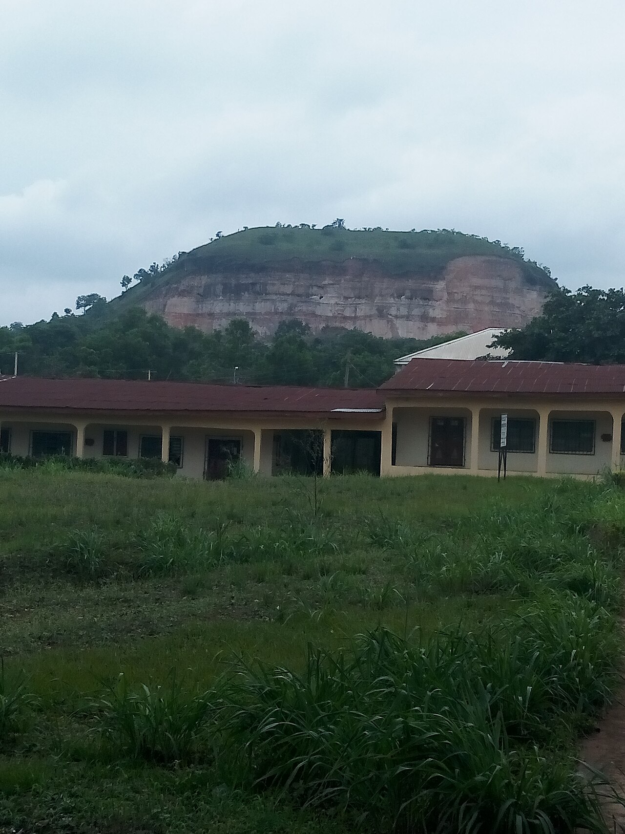
Isuikwuato is the cool upland country of Abia's north-west, on the road to Enugu, and its communities include Uturu, Umuobiala and their villages. Abia State University's main campus stands at Uturu, and the photograph in this gallery is of the hills above it. The people's own tradition places them in the Isu stock of Igbo groups, a claim of common descent with communities far beyond the state rather than a dated record, and the land around them is upland farm and quarry country: cassava, yam and palm on the slopes. There is a waterfall on the hills, recorded in the culture entry for Isuikwuato and the Isu; the community's account of where it is and how it is reached is not yet in this record, and the platform does not guess a route. Photographs, via Wikimedia Commons: The hills above Abia State University, Uturu - MaziIwu, CC BY-SA 4.0. Licences: https://creativecommons.org/licenses/by-sa/4.0/
What to see
- 1
The hills above the campus
The upland the photograph is taken from, above Abia State University's main campus.
- 2
Abia State University, Uturu
The university whose campus gives the town its modern shape.
- 3
The waterfall on the hills
The waterfall the culture entry records, whose access is the community's to describe.
Culture around this place
Stories, heritage and traditions connected to Uturu and the Isuikwuato hills and its region.
Nearby places
Continue through the same region and build a fuller visit.
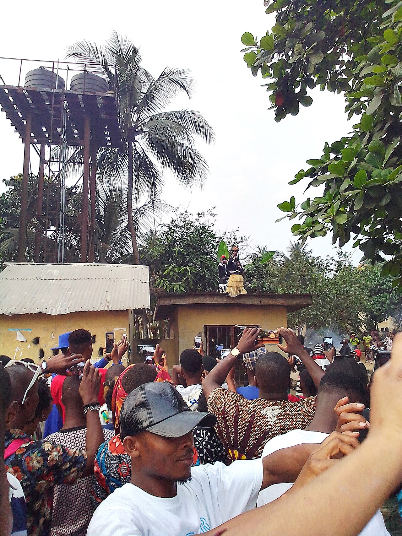 FestivalsAkirikaThe Nwaotam festival at AkirikaThe Nwaotam festival at Akirika, in Ukwa East, is kept on the first of January, and the photograph in this gallery is of a crowd at the celebration. Ukwa East calls itself Eastern Oil Land, its people are the Ndoki, and its best-known things are water and cloth - the Azumini Blue River and Akwete cloth, which have their own entries beside this one. The community's own account of Nwaotam, what it marks and who keeps it, is the source this entry is waiting for. Photographs, via Wikimedia Commons: A crowd at the Nwaotam festival, Akirika - Dalli Gozie K., CC BY-SA 4.0. Licences: https://creativecommons.org/licenses/by-sa/4.0/
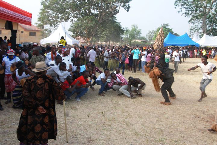
 FestivalsNkporoThe Ukpo festival at NkporoUkpo is kept by Ndi Nko, Nkporo, in the Ohafia local government area, and on 4 October 2025 the community held it; the photographs in this gallery are of that day. This entry is deliberately short. Nkporo's own account of what Ukpo is, who may keep it and what it obliges is the entry's proper source, and it is still to be written here. What the platform can say now is what it has: the community, the place and the date. Photographs, via Wikimedia Commons: The Ukpo festival at Nkporo, Ohafia, 2025 - Eskimo2.0, CC BY-SA 4.0 (photograph 1 in this gallery). The Ukpo festival at Nkporo, Ohafia, 2025 - Eskimo2.0, CC BY-SA 4.0 (photograph 2 in this gallery). Licences: https://creativecommons.org/licenses/by-sa/4.0/
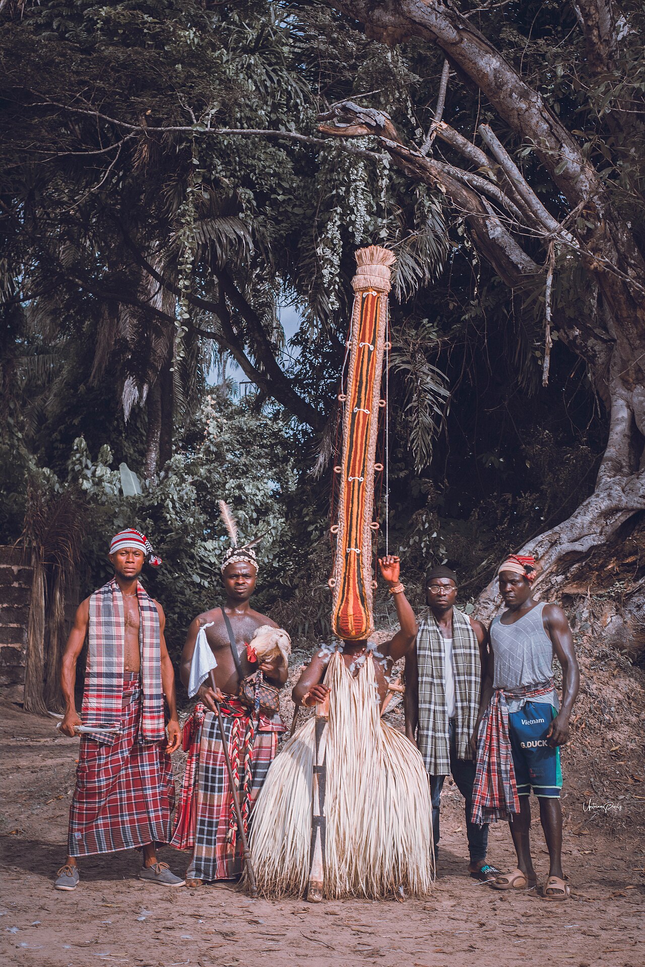
 HeritageBendeBendeBende is the middle belt of Abia and one of the state's two colonial divisions: Ndi Bende, the people of the old Bende Division of the Owerri Province, whose towns include Bende itself, Item, Igbere, Alayi, Ozuitem and Uzuakoli. The division's courts, schools and mission stations made it one of the most recorded parts of the present state. Alayi is known for pottery, a women's craft of a very old kind; Uzuakoli carries the memory of the Methodist mission's leprosy settlement and research centre and the college that grew beside it; and the 1929 tax protest that became the Women's War began inside the division, at Oloko. The masquerade and the festival year are kept as they are across Igbo land, with Iri ji, age grades and wrestling, and the photographs in this gallery are from a Bende cultural festival. Photographs, via Wikimedia Commons: A masquerade at a Bende cultural festival - Peddykal, CC BY-SA 4.0. A chief in Bende - Peddykal, CC BY-SA 4.0. Licences: https://creativecommons.org/licenses/by-sa/4.0/
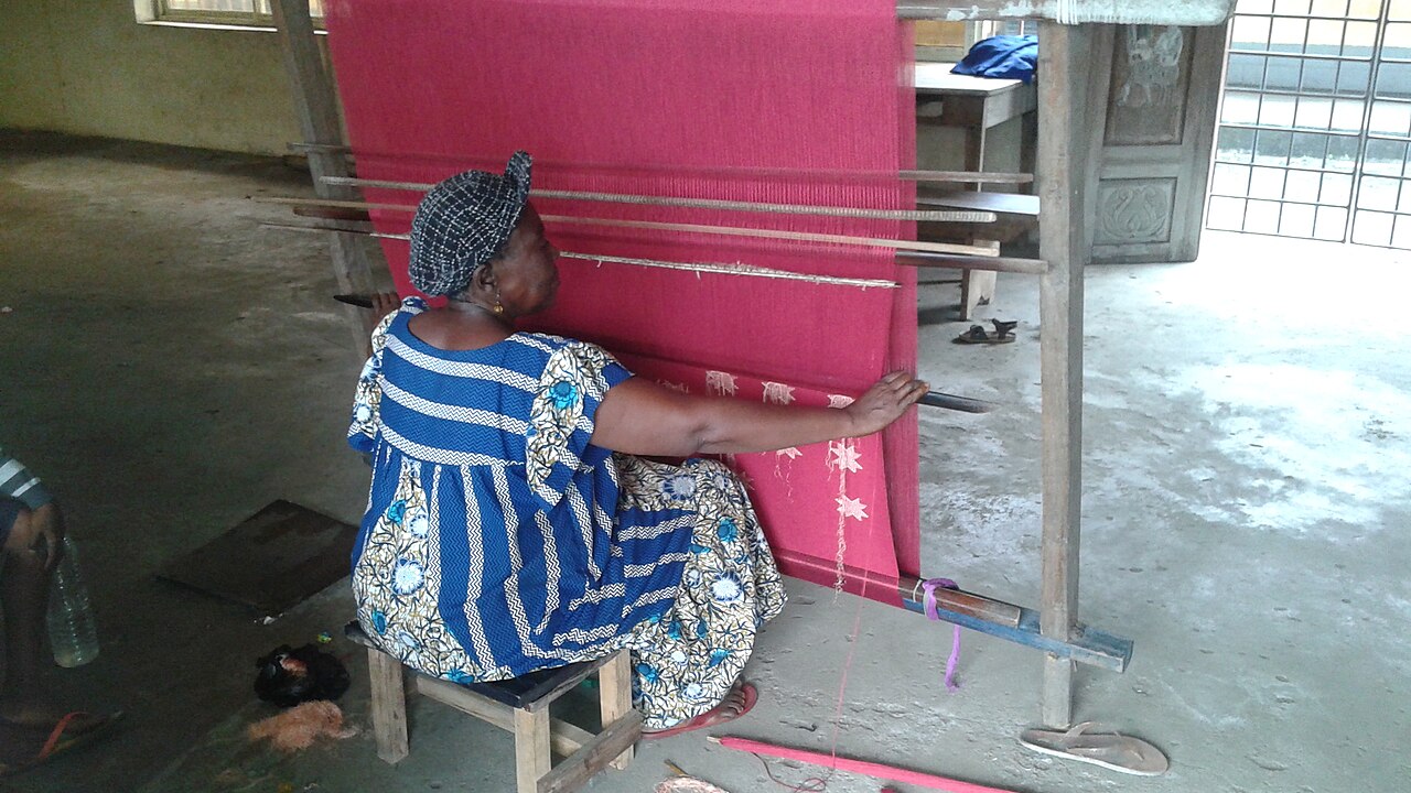 HeritageAkweteAkwete, the weaving townAkwete is the headquarters of Ukwa East and the town that gives Akwete cloth its name, and it is where the cloth is still woven. The weavers work on an upright loom that stands with the warp stretched before a seated weaver, which is what distinguishes Akwete weaving from the narrow-strip horizontal loom of western Nigeria; the two photographs in this gallery are of that loom in use. The cloth is worked from sisal, hemp, raffia and dyed cotton - coarse raffia went to masquerade and, in the past, to warriors' headgear, while spun cotton goes into cloth for wearing - and it is known for its motifs, of which ikaki, the tortoise, is the one most often named. Evidence of the craft goes back to the mid-nineteenth century, its principal customers were the Ijaw trading groups of the Niger Delta, and Ndoki women still weave it for a market that is now global. The culture entry for Akwete cloth describes the craft; this place is the town where it is done. How a visitor sees the work is the weavers' arrangement, and the platform prints no price or time it cannot source. Photographs, via Wikimedia Commons: Weaving Akwete cloth on the loom - OBankz (Ekekeh Ubadire Obioma), CC BY-SA 4.0 (photograph 1 in this gallery). Weaving Akwete cloth on the loom - OBankz (Ekekeh Ubadire Obioma), CC BY-SA 4.0 (photograph 2 in this gallery). Licences: https://creativecommons.org/licenses/by-sa/4.0/
Its address is /tourism/uturu on www.buzzbuntu.com.